Fall Hiking Guide: 9 Picture-perfect trails
Underrated spots for fall colors in North Carolina
You don’t have to travel to the mountains to find those picturesque fall colors. Skip the crowds and discover some of the best spots to experience the changing leaves right here in the Piedmont Triad.
Across our 12-county region, you’ll find plenty of places to catch fall colors, from wooded hiking trails and lakeside loops to routes that follow rivers and streams. We’ve rounded up nine trails worth checking out this fall. Pick one near you, bring a friend or the family, and see what you find along the way. Trail conditions and fall colors change throughout the season, so there’s always a reason to get back out there.
If you head out, tag @PiedmontLegacyTrails and use #GreatTrailsState to share your hike with us.
1.Carter Falls via Grassy Creek Vineyard Trail | Surry County
Grassy Creek Vineyard tasting room 235 Chatham Cottage Ln, State Road, NC 28676
Combine a hike with a vineyard visit on this trail network near Elkin. Starting at Grassy Creek Vineyard, follow the trail toward the dam mural, then continue along signed routes toward Carter Falls and the historic powerhouse. The waterfall and powerhouse each have their own short spur trail from the Carter Falls trailhead. Along the way, you’ll cross roads and pass through Byrds Branch Campground, so follow the trail markers and check a map before heading out.
Grassy Creek Trail is part of Segment 6 of North Carolina’s Mountains-to-Sea Trail and includes the state’s first forest-bathing trail. The trail network is maintained in partnership with the Elkin Valley Trails Association. Parking at the vineyard is available for hikers, but check the vineyard’s website for current tasting room hours if you plan to stop in afterward.
For route options and trail maps, visit the Elkin Valley Trails Association.
- Accessibility: Natural-surface trails include exposed roots, stone steps, and uneven terrain. The routes to Carter Falls and the powerhouse may be challenging for hikers with mobility limitations.
- Planning tip: Allow extra time if you want to explore multiple trail sections, and return to the vineyard along the same route.
- Distance: Up to 5.5 miles
- Type: Trail System
- Difficulty: Moderate
- Highlights: Mural, Vineyard, Forest Bathing Trail
2. Cook’s Wall Trail | Stokes County
Parking: 2847 Hanging Rock Park Road in Westfield
Cook’s Wall Trail leads through the rocky, wooded landscape of Hanging Rock State Park to sweeping views of the Piedmont, with Sauratown and Pilot mountains visible in the distance. Along the way, you’ll pass dramatic rock formations, including Devil’s Chimney, and can explore the nearby House Rock formation.
The trailhead is behind the bathhouse at the lake parking lot. Cook’s Wall and Wolf Rock trails share a route at first, passing the Chestnut Oak Nature Trail junction before splitting at a fork. Keep right for Cook’s Wall. The trail is also open to climbers with a permit, so be prepared to share the route.
- Accessibility: The trail has a natural surface of gravel, dirt, and rock, with uneven steps and rocky terrain. It is not ADA accessible and may be challenging for hikers with mobility limitations.
- Distance: 2.2 Miles
- Type: Out and back
- Difficulty: Moderate
- Highlights: Panoramic views, Rock formations
3. Knight Brown Nature Preserve | Rockingham County
221 Waterfield Ln. Stokesdale, NC
Explore nearly 5 miles of interconnected hiking trails at Knight Brown Nature Preserve, a 189-acre protected landscape near Belews Lake. The trails wind through a wooded valley, follow two streams, and climb along ravines beneath a mature forest canopy. Keep an eye out for five realistic wooden animal sculptures carved by a local chainsaw artist and tucked throughout the preserve. In fall, golden beech leaves add another reason to explore. Follow the connecting loops to discover the preserve’s different landscapes and hidden details.
- Accessibility: Trails have natural surfaces with exposed roots, rocks, and uneven terrain. The route begins with a steep descent, includes elevation changes, and crosses two bridges with steps up and down. Not recommended for visitors seeking an easy or accessible walk.
- Distance: Up to 5 miles
- Type: Trail System
- Difficulty: Moderate
- Highlights: Sculptures, Beech Trees
4. Yadkin Memorial Park Trails | Yadkin County
Park Office: 1142 Crystal Lane, Yadkinville, NC 27055
Yadkin Memorial Park East: 2513 Ireland Rd, Yadkinville, NC 27055
Explore more than 5 miles of trails at Yadkin Memorial Park along Lake Hampton. The longest route, the approximately 3-mile Ashley Ladd Trail, winds through shaded woods, follows the lakeshore, passes behind the Hood-Chamberlain Dam, and crosses South Deep Creek on a pedestrian bridge. Expect peaceful lake views, streams, native vegetation, and gently rolling terrain. The park also offers a paved walking loop near the main lake recreation area.
- Accessibility: Yadkin Memorial Park has multiple trail sections. The paved loop provides a smoother option for walking and jogging. The Ashley Ladd Trail follows a natural surface with some uneven terrain, creek crossings, and a gravel section near the dam. The natural-surface trail is not fully paved or universally accessible.
- Distance: 5+ miles
- Type: Trail System
- Difficulty: Moderate
- Highlights: Lake views, wooded trails, dam, pedestrian bridge
5. Salem Lake Trail | Forsyth County
Salem Lake Rd Trailhead: 815 Salem Lake Road
Winston-Salem
Linville Rd Trailhead: Linville Rd SE, Winston-Salem, NC 27107
A Winston-Salem favorite, the 7-mile Salem Lake Trail loops around the lake, offering peaceful water views and colorful fall foliage. The lake is also popular for fishing, paddleboarding, and kayaking. The trail is approximately 8 feet wide and consists primarily of dirt and natural surfaces, with some paved sections. Enjoy a mix of shaded woodland and open lake views along this popular route.
Salem Lake Trail connects to Salem Creek Greenway, providing access to additional greenway miles and destinations throughout the city. Restrooms are available at both the Salem Lake Road and Linville Road trailheads.
- Accessibility: The trail has a mix of dirt, natural, and paved surfaces, which may become uneven or muddy depending on conditions. While much of the route is relatively flat and wide, it is not uniformly paved or guaranteed to be suitable for all strollers or mobility devices.
- Planning your visit: Explore our Winston-Salem Greenway Guide for more trails and greenway connections in the area.
6. Atlantic & Yadkin Greenway | Guilford County
Anna Long Marshal Wayside: 4310 US-220, Summerfield, NC 27358
Bur-Mill Park: Atlantic & Yadkin Greenway, Greensboro, NC 27455
Country Park: 3905 Nathanael Green Dr, Greensboro, NC 27455
SERVICE ALERT: The northernmost trestle bridge between Bur-Mil Park and Strawberry Road is closed for replacement, and there is no paved detour.
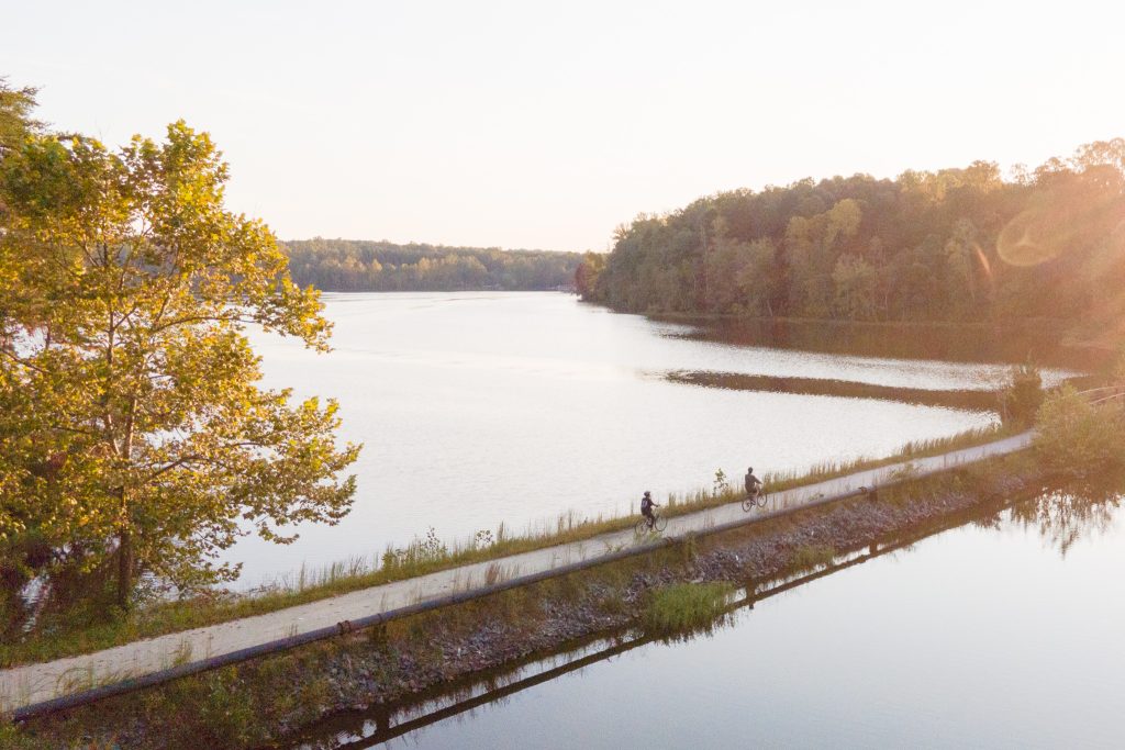
The Atlantic & Yadkin Greenway follows a paved route through wooded areas and alongside Lake Brandt, connecting parks and other trails in Greensboro. It’s a good option for a walk, run, or bike ride, with opportunities to explore nearby natural-surface trails along the way. Connect to the Nat Greene Trail, Palmetto Trail, and Owl’s Roost Trail, or explore the Big Loop and Little Loop trails at Bur-Mil Park. The greenway also connects with the Bicentennial Greenway near Old Battleground Road and Lake Brandt Road.
Parking and trail information are available at several access points, including Bur-Mil Park, Country Park, and the Guilford Courthouse National Military Park parking area on Old Battleground Road.
- Accessibility: The greenway has a paved asphalt surface, which provides a smoother route for walking, running, and biking. The bridge closure affects through-travel, so plan your route around the closed section.
- Distance: 7.5 miles
- Type: Out-and-Back
- Difficulty: Easy
- Highlights: Lake views, wooded scenery
7. Cedarock Park | Alamance County
4242 R Dean Coleman Rd, Burlington, NC 27215
For a different way to explore the woods, try the Wellspring Disc Golf Course at Cedarock Park. This 18-hole course winds through a heavily wooded section of the park, with hills, tight fairways, and creek crossings that make accuracy more important than power. It’s a fun option for combining time outdoors with a little friendly competition. Bring your own discs or check with the park about rentals.
Cedarock Park has additional outdoor options, including hiking and equestrian trails, a historic farm, and a waterfall over an old mill dam. If you’d rather take a walk than play a round, the half-mile Curtis Mill Trail leads to the waterfall and connects with the Rock Creek Trail.
- Accessibility: Wellspring’s disc golf course has hilly, uneven terrain and is not recommended for visitors with limited mobility. For a shorter walk, the half-mile Curtis Mill Trail is paved and offers a smoother route to the waterfall.
- Distance: ~1.6 miles
- Type: Disc golf course
- Difficulty: Moderate to challenging
- Highlights: Wooded course, creek crossings, waterfall
8. Boones Cave Park | Davidson County
3552 Boone's Cave Road Lexington, NC 27292
Carved into a ridge overlooking the Yadkin River, the caves at Boone’s Cave Park are said to have sheltered a young Daniel Boone and his family. Beyond the caves, explore approximately 7 miles of trails winding through the park’s wooded landscape. Check the trail map to connect routes and discover the park’s highlights, including the caves, river overlooks, and natural areas. The park also offers affordable campsites, a disc golf course, and river access for paddling adventures on the Yadkin.
- Accessibility: Trails vary in terrain and difficulty. Reaching the caves requires a steep descent and wooden stairs, making this area unsuitable for visitors who cannot manage steep slopes or steps. The river access area has ADA parking, but the natural-surface trails may include uneven terrain and are not necessarily wheelchair accessible.
- Distance: Up to 7 Miles
- Type: Trail System
- Difficulty: Moderate
- Highlights: Cave, Yadkin River
9. Caraway Creek Preserve | Randolph County
829 Jerico Rd. Asheboro, NC
On the northern edge of the Uwharrie Mountain range, hike up to 4 miles at Caraway Creek Preserve. It is truly a walk through history as you meander through an old barn and home site, and historic check dam.
A main feature of the preserve is a historic check dam, seen from the Caraway Forks Trail. This dam was likely built in the early 1900s as a method for silt-retention and flood prevention. Its large size and considerable craftsmanship are best appreciated in person. Other features of the preserve are mature forests, hikes along ravine edges, and spectacular flora and fauna, as the preserve is located near lots of other PLC protected land.
- Accessibility: The natural surface with roots, rocks, and multiple steep areas make this trail very difficult to access.
- Distance: Up to 4 miles
- Type: Trail System
- Difficulty: Moderate
- Highlights: Historic Dam, Caraway Creek, Bluffs and Ravines, Mature Forest
Have you ever wondered where these colors come from?
During the warmer months, leaves contain chlorophyll, the green pigment that helps trees turn sunlight into energy. As days get shorter in the fall, trees produce less chlorophyll, allowing other colors to show through. Carotenoids create yellow and orange hues, while anthocyanins produce many of the reds and purples we see in autumn.
These changing colors are one of the many reasons we love exploring the Piedmont’s forests. Keeping these landscapes healthy matters, too. Piedmont Land Conservancy works to protect the region’s natural lands, forests, farms, and waterways, helping safeguard the places that support wildlife, protect clean water, and give people room to connect with nature.
Learn more about how Piedmont Land Conservancy protects the Piedmont.
View this profile on InstagramPiedmont Legacy Trails (@piedmontlegacytrails) • Instagram photos and videos